sketchup4architect
Follow us at Facebook Follow us at Twitter
Mail: enquiry@sketchup4architect.com | Call: 866 - 493 - 4944
 
Home | Services | Components | Plug-ins | Jobs |Magazine | Advertising | Media kit | Product | Blog|Contact Sketchup Samples | Video | Get Quote
sketechup ur space
POPULAR SKETCHUP PLUGINS
◊ Vue Exporter Plugin V2.0 new
◊ Pointools new
◊ Podium Walker new
◊ SU Walk new
◊ Bloom Unit new
◊ Sefaira Concept new
◊ Podium
◊ Maxwell Render 2.6
◊ V-Ray for SketchUp version 1.49.01
◊ Lightup for Sketchup
◊ Indigo Renderer
◊ Ies ve Sketchup Plugin
View more


TacForge GeoSketch

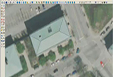
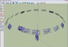
TacForge GeoSketch enables SketchUp to load natively and interactively work with multiple commercial and military UAV Videos, overhead oblique images, and handheld photos (with/without camera models) to build geo specific 3D geometry with textures.

TacForge GeoSketchâ„¢ Pro v3.2 Available

New Features

  • Added additional elevation support (RPC transform).
  • Added the flat roof settings (includes overhang and parapet options).
  • Added settling option to loaded terrain (basement option for flat and pitched roofs).
  • Added the gambrel and round roof options to the pitched roof tool.
  • Added the measure height tool (measure heights from AuxView).
  • Added the dome and basement option to the Peak tool
TacForge GeoSketch TacForge GeoSketch Model

GeoSketch supports using the same images for texturing multiple models, meaning as you refine the models the camera models automatically updated and the pixels are corrected on the other 3-D models at the same time.

GeoSketch plug-in, Google SketchUp has taken a significant leap forward to support the ability to create 3-D models with:

♦ UAV Video
♦ Oblique imagery
♦ Handheld Imagery
♦ Satellite Imagery
♦ Imagery with and without camera models


sketchup4architect
  Articles | About us | News | Faqs | Sitemap
Valid HTML 4.01 Transitional All right reserved. All site content copyright
Site Developed by
GlobalAssociates
Valid CSS!