SketchUp in Urban Planning: Crafting Smart Cities through Visualization and Engagement
In the dynamic field of urban planning, where the complexity of cityscapes meets the aspirations for sustainable and inclusive development, tools that aid visualization and community engagement are indispensable.
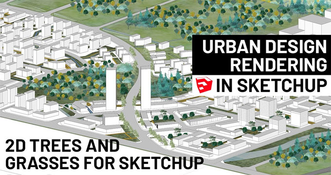
SketchUp, a 3D modeling software, has emerged as a powerful ally for urban planners, enabling them to model cityscapes, visualize development plans, analyze traffic flow, and engage communities in participatory planning.
Modeling Cityscapes with SketchUp
1. Visualizing Development Plans
One of the key strengths of SketchUp lies in its ability to bring urban planning concepts to life. Planners can use the software to create detailed 3D models of proposed developments, allowing stakeholders to visualize the project in a way that traditional 2D plans cannot achieve.
This visual representation aids in conveying the scale, design elements, and overall impact of the development, fostering a deeper understanding among decision-makers and the community.
2. Analyzing Traffic Flow
Urban planners grapple with the challenge of managing traffic flow in increasingly complex city environments. SketchUp's capabilities extend beyond static models; it allows for dynamic analysis, including traffic simulations. Planners can integrate data on traffic patterns, pedestrian movement, and public transportation routes into their 3D models. This not only aids in identifying potential congestion points but also facilitates the optimization of road networks and the development of efficient urban transportation solutions.
3. Integrating Geographic Information Systems (GIS)
To enhance the accuracy and functionality of urban models, SketchUp can be integrated with Geographic Information Systems (GIS). This integration allows planners to incorporate geospatial data such as land use, zoning information, and topography into their models. By combining SketchUp's visual prowess with GIS data, planners can create holistic urban models that reflect the geographical context of a city, providing a comprehensive foundation for decision-making.
Participatory Planning and Community Engagement
1. Enabling Inclusive Design through Collaboration
SketchUp serves as a bridge between urban planners and the community by enabling collaborative design processes. Planners can create simplified models or design options using SketchUp and share them with residents, businesses, and other stakeholders.
This participatory approach fosters a sense of inclusivity, allowing community members to provide input, express preferences, and actively contribute to the decision-making process.
2. Virtual Reality (VR) and Augmented Reality (AR) Experiences
Advancements in technology have expanded the capabilities of SketchUp beyond traditional modeling. Planners can leverage VR and AR experiences to immerse stakeholders in virtual urban environments.
This not only enhances the visual impact of proposed developments but also provides an interactive platform for community members to explore and understand different aspects of the plan. VR and AR experiences facilitate a more nuanced dialogue between planners and the community, fostering a sense of ownership and shared vision for the city.
3. Crowdsourcing Urban Data
In the age of information, SketchUp empowers urban planners to tap into the collective intelligence of the community. Planners can create simplified SketchUp models and distribute them to the public, encouraging residents to contribute information about their neighborhoods.
This crowdsourced data can include feedback on public spaces, suggestions for improvements, or observations about community needs. By integrating this valuable input into urban models, planners can ensure that their designs align with the actual experiences and aspirations of the people who live and work in the city.
Innovative Applications in Urban Planning with SketchUp
1. Green Infrastructure Planning
As cities strive to become more sustainable, urban planners are turning to SketchUp to model and analyze green infrastructure. This includes the integration of parks, green spaces, and sustainable design elements into the urban fabric.
Planners can simulate the environmental impact of green infrastructure, assess the effectiveness of green roofs, and visualize how these elements contribute to overall urban resilience. SketchUp's intuitive platform allows for the seamless integration of sustainability principles into the planning process.
2. Tactical Urbanism and Temporary Interventions
SketchUp's flexibility makes it an ideal tool for planners engaging in tactical urbanism – quick, low-cost, and temporary interventions to improve public spaces. Planners can use SketchUp to model temporary parklets, pop-up markets, or street redesigns.
These visualizations aid in obtaining approvals, garnering community support, and showcasing the potential impact of these interventions. By rapidly prototyping ideas with SketchUp, planners can test concepts before implementation, ensuring that temporary interventions contribute positively to the urban environment.
3. Historic Preservation and Adaptive Reuse
Preserving the historical character of cities is a critical aspect of urban planning. SketchUp plays a pivotal role in historic preservation by allowing planners to model existing structures and simulate proposed alterations.
This aids in assessing the impact of development on historical sites and facilitates adaptive reuse projects. By visualizing how new elements integrate with existing structures, planners can strike a balance between progress and preservation, ensuring the longevity of architectural heritage in the urban landscape.
Challenges and Considerations
While SketchUp offers a plethora of benefits for urban planners, there are challenges to consider. Training and skill development are essential for planners to fully harness the capabilities of the software.
To learn more, watch the following video tutorial.
Video Source: SketchUp
Additionally, ensuring data accuracy and integrating SketchUp models with other planning tools may pose technical challenges. Collaborative efforts between software developers, urban planners, and community stakeholders are crucial to addressing these challenges and optimizing the use of SketchUp in urban planning.
Conclusion
SketchUp has evolved from a versatile 3D modeling tool to a catalyst for smarter and more inclusive urban planning. Its applications in visualizing development plans, analyzing traffic flow, and engaging communities in participatory planning are reshaping the way cities are designed and developed.
As technology continues to advance, SketchUp's role in urban planning is likely to expand, offering new possibilities for sustainable, resilient, and community-centric cityscapes. By embracing SketchUp as a tool for innovation, urban planners can navigate the complexities of modern urban environments and collaboratively build cities that truly reflect the needs and aspirations of their communities.