SketchUp for Community Mapping: Creating Interactive and Informative Maps
In the ever-evolving landscape of urban development and community planning, the role of technology cannot be overstated. One such powerful tool in the arsenal of urban planners, architects, and community organizers is SketchUp. Originally designed for architectural modelling, SketchUp has transcended its initial purpose and found a unique niche in community mapping.
The Evolution of Community Mapping
Community mapping has come a long way from traditional paper maps and static diagrams. In the digital age, communities demand more dynamic, interactive, and accessible ways to understand and engage with their surroundings. This is where SketchUp, a 3D modelling software, steps in to revolutionize the process.
The Power of 3D Models
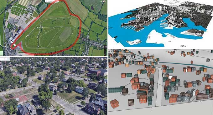
SketchUp's forte lies in its ability to create detailed and realistic 3D models of physical spaces. This feature is invaluable for community mapping as it allows planners and organizers to visualize spaces in three dimensions. Traditional maps, limited to two dimensions, often struggle to convey the complexity of urban environments. With SketchUp, urban planners can model not only the physical structures but also the terrain, green spaces, and other contextual elements, providing a more comprehensive view.
Integrating Geospatial Data
SketchUp's compatibility with geospatial data is a game-changer for community mapping. The software allows users to import geographic information system (GIS) data directly into their models. This integration enables planners to overlay maps with real-world data such as land use, population density, and infrastructure, enhancing the accuracy and relevance of community maps.
The SketchUp Advantage in Community Mapping
User-Friendly Interface
One of the primary reasons SketchUp has gained popularity in community mapping is its user-friendly interface. Unlike some complex GIS software, SketchUp is intuitive and accessible to users with varying levels of technical expertise. This simplicity ensures that community members, not just professionals, can actively participate in the mapping process, contributing their local knowledge and insights.
Versatility in Visualization
SketchUp's versatility is a key asset in community mapping projects. It allows users to create a wide range of visualizations, from simple 3D models to intricate, data-rich maps. This flexibility is crucial in engaging diverse audiences, as different stakeholders may require varying levels of detail and complexity in the maps they interact with.
Collaboration and Community Engagement
Community mapping is inherently a collaborative process, requiring input from various stakeholders. SketchUp, being a cloud-based platform, facilitates seamless collaboration among team members, whether they are in the same room or scattered across the globe. This collaborative aspect extends to community engagement, allowing residents to actively participate in the mapping process. By providing a platform where community members can contribute their insights and feedback, SketchUp transforms mapping from a top-down exercise to a communal effort.
The Process of Creating Interactive Community Maps with SketchUp
1. Data Collection and Preparation
The first step in creating interactive community maps with SketchUp involves gathering relevant data. This includes geospatial data, such as GIS files and satellite imagery, as well as local knowledge from community members. Once collected, the data needs to be organized and prepared for integration into SketchUp.
2. Importing Geospatial Data
SketchUp's geolocation feature allows users to import geospatial data directly into their models. This step ensures that the 3D model aligns accurately with the real-world geography. This alignment is crucial for overlaying additional information, such as land use or zoning data, onto the model.
3. Building 3D Models
With the geospatial data in place, the next step is to start building the 3D model. SketchUp's user-friendly interface makes this process accessible to both professionals and community members. The software provides a range of tools for creating structures, landscapes, and other elements, allowing for a high level of customization.
4. Overlaying Data and Information
Once the basic 3D model is complete, the real power of SketchUp in community mapping comes to the fore. Users can overlay various data layers onto the model, enhancing its informational value. This can include demographic data, infrastructure details, environmental factors, and more. The ability to visualize this data in a 3D context provides a richer understanding of the community's dynamics.
5. Adding Storytelling Elements
To make community maps truly engaging, storytelling elements can be incorporated into SketchUp models. This could involve creating interactive markers that when clicked, reveal information about specific locations, historical details, or planned developments. These narrative features not only make the maps more interesting but also serve as educational tools for community members.
6. Review and Feedback
The iterative nature of community mapping often requires multiple rounds of review and feedback. SketchUp's collaboration features make it easy for different stakeholders to review the maps, provide comments, and suggest modifications. This ensures that the final product is a collective representation of the community's vision and needs.
Case Studies: SketchUp in Action
1. Redesigning Public Spaces in Chicago
The city of Chicago embarked on a community-driven initiative to redesign several public spaces, including parks and plazas. SketchUp was used to create 3D models of the existing spaces, incorporating input from local residents regarding their usage patterns and preferences. The interactive maps allowed community members to virtually explore proposed changes and provide feedback, leading to a final design that truly reflected the needs and desires of the residents.
2. Urban Planning in Singapore
Singapore, known for its meticulous urban planning, employed SketchUp in a large-scale community mapping project. The software was used to model the city's existing infrastructure, including buildings, roads, and green spaces. By integrating real-time data on traffic flow, population density, and environmental factors, planners were able to simulate various development scenarios and their impact on the community. This data-driven approach informed decision-making and allowed for a more sustainable and responsive urban development plan.
Challenges and Future Considerations
While SketchUp offers tremendous advantages in community mapping, it is not without its challenges. One notable limitation is the learning curve for users unfamiliar with 3D modelling and mapping concepts. To address this, comprehensive training programs and educational resources are essential to empower community members and professionals alike.
The future of community mapping with SketchUp holds exciting possibilities. The integration of augmented reality (AR) and virtual reality (VR) technologies could take interactive maps to a new level, allowing users to immerse themselves in virtual representations of their communities. Additionally, advancements in artificial intelligence may enable more automated processes for data analysis and model generation, streamlining the mapping workflow.
To learn more, watch the following video tutorial.
Video Source: Modelur
Conclusion
SketchUp's role in community mapping is a testament to the software's adaptability and versatility. By providing a platform that is both powerful and user-friendly, SketchUp empowers communities to actively participate in the planning and development of their spaces. The creation of interactive and informative maps goes beyond traditional methods, fostering a deeper understanding of the dynamics shaping our communities.
As technology continues to advance, so too will the potential for SketchUp to revolutionize the way we visualize and engage with the spaces we inhabit. In the hands of planners, architects, and community members, SketchUp becomes not just a tool for mapping but a catalyst for collaborative and sustainable urban development.